
When we track birds (measure their movements) over long periods of time, it is important to use small data loggers so that individuals don’t have to carry large amounts of excess weight. During the breeding season, we consider <3% of an individual’s weight a good guideline. For example, if you weigh 60 pounds, that means you would be tasked with carrying around something that is 1.8 pounds. You might not be too bothered unless you had to carry it for a few weeks or a couple months. So, for yearly deployments we try to use something that is less than 1% of an individuals’ weight. The data loggers that we are currently using to track red-legged kittiwakes on St. George Island weigh just 1 gram (similar to a large paperclip), so just 0.2% of the average kittiwake’s weight!
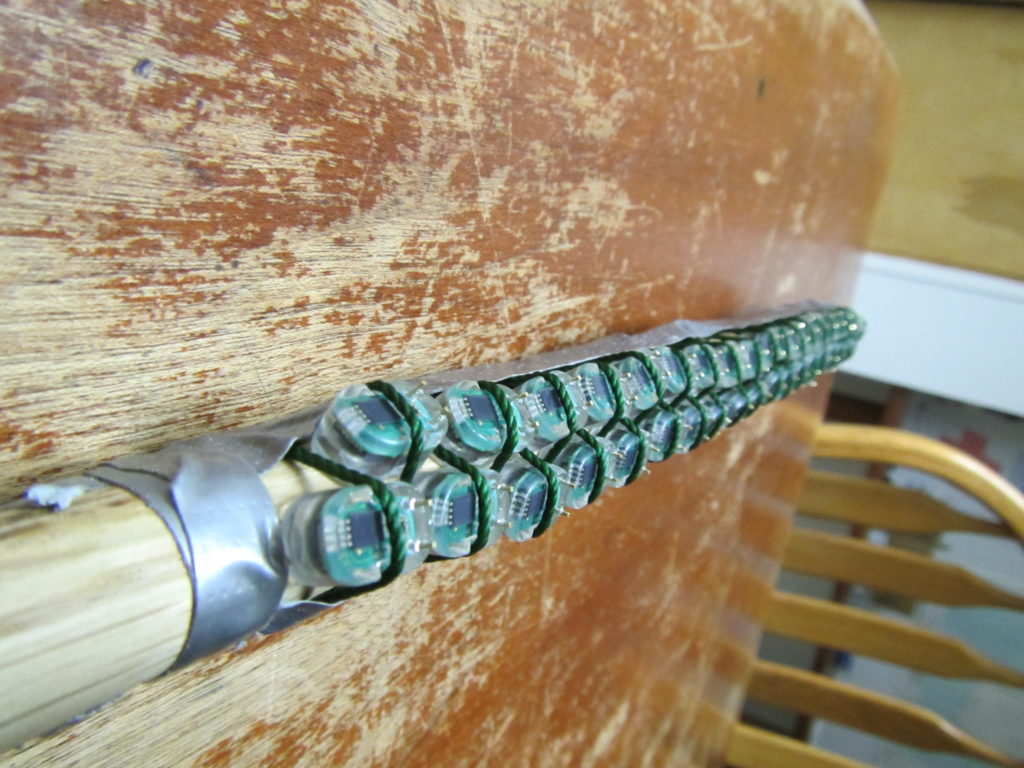
Geolocation dataloggers lined up on a pole for testing. Photo by Abram Fleishman
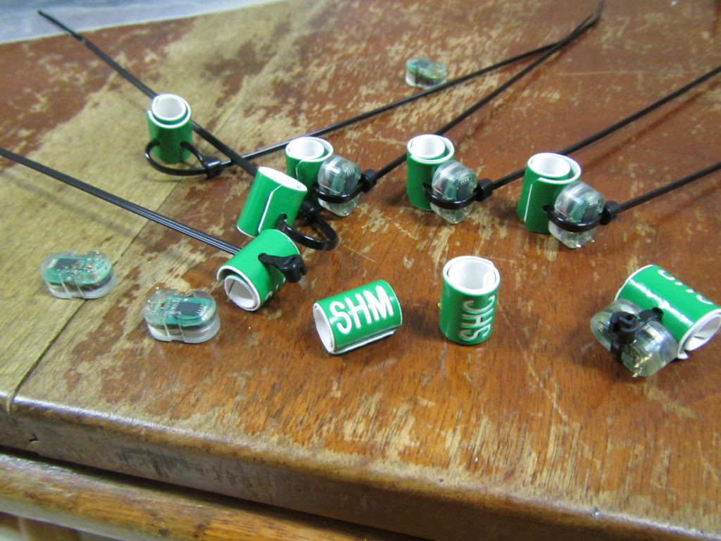
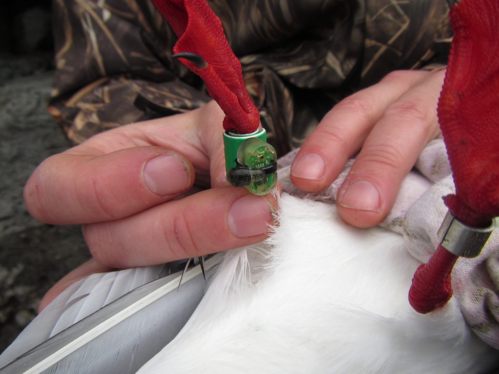
Attaching geolocation dataloggers to bands for kittiwakes. The final product is on the right.
Photo by Abram Fleishman
What do geolocation loggers do?
We use geolocation loggers to track the movements of kittiwakes for a whole year. Geolocation loggers have two sensors, one for light and one that measures conductivity (to identify when the logger is in water). They also keep track of the time.
Light and time are critical to the calculations that are used to estimate location. Much like sailors used to navigate across oceans with a sextant and a clock, geolocation loggers can be used to calculate locations. We use the light record to identify sunrise and sunset. Longitude calculations are typically more accurate and calculated by knowing the time of local noon or local midnight (midway between sunrise and sunset). Latitudes are calculated from the length of day or night.
Can you think of a time of year when this might not work?
Using this method (and some fancy statistical models) we can estimate locations of birds +/- 114 miles. Not exact locations, but pretty good for a bird that might travel from Alaska to the Antarctic (like an Arctic Tern), or from New Zealand to Alaska, Japan and/or California (like a sooty shearwater), or even just across the North Pacific like black-legged kittiwakes from the Pribilof Islands.
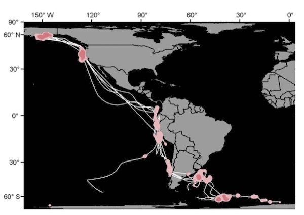
Geolocation tracks of Arctic Terns tracked from Alaska to Antarctica. Data from McKnight et al 2013
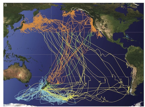
Geolocation tracks from sooty shearwaters tracked from their breeding colony in New Zealand. Data from Shaffer et al 2006.
We are currently using geolocation loggers to track red-legged kittiwakes from St. George Island to see how their wintering strategies change annually and connect what they do during the winter to their reproductive effort in the summer and vice versa. This will be the 5th winter of tracking and we are very curious to see where the birds went this winter in relationship to the sea ice edge.
Retrieving a geolocation data logger from a red-legged kittiwake after a year deployment.
Photo by Abram Fleishman
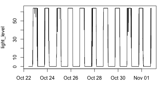
Light data from a geolocation logger deployed on a red-legged kittiwake
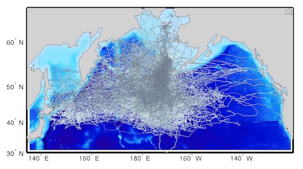
Geolocation tracks from black-legged kittiwakes tracked from the Pribilof Islands.
Data from Orben et al Movement Ecology 2015.