Pribilof Seabird Diets
Pribilof seabird diets show an increase of an Arctic-dwelling zooplankton
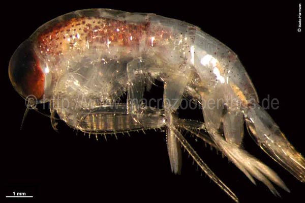
The Pribilof Islands are located in the Bering Sea. The temperature of the Bering Sea varies among years, and water temperatures have been cold with a lot of sea ice since 2008. Colder water temperatures have resulted in an increase in the number of Themisto Libellula, a tiny crustacean that usually lives in the Arctic. This small crustacean is one of many types of zooplankton. They are good swimmers, live in dense swarms, and are full of fatty oils that make a nutritious meal for predator fish, and seabirds.
The increased population of this tiny crustacean affects the marine food web.
UP THE FOOD WEB: In recent cold years, fish (such as Pacific herring, Pacific cod, and salmon) and seabirds (such as the Least Auklet) in the Bering Sea are eating large numbers of this tiny Arctic crustacean.
DOWN THE FOOD WEB: This Arctic crustacean is also a predator, and is preying on a smaller Bering Sea zooplankton known as Calanus.
TAKE HOME MESSAGE: Everything is connected. A change in sea-water temperatures brings on a series of changes that affect many species.
Researchers: Alexei Pinchuk, Ken Coyle, and Heather Renner
KEYWORDS
Predator: an animal that hunts and kills other animals to eat.
Prey: an animal eaten by a predator
Crustacean: a large class of arthropods that have a hard chitinous or calcareous exoskeleton. They include lobsters, crabs, shrimps and water fleas. Zooplankton: an animal that drifts in water.
Population: the total number of individuals in an area.
Food Web: interacting food chains in an ecological community
Swarms: a large number of things that mass together, usually in motion
KEY CONCEPTS
Scientific name: a formal system of naming species with a Latin name. The first part identifies the genus, the second part identifies the species within the genus.
Food chain: an arrangement of organisms in an ecological community according to their order of predation. Each organism usually eats the next lower member in the chain.
COASST
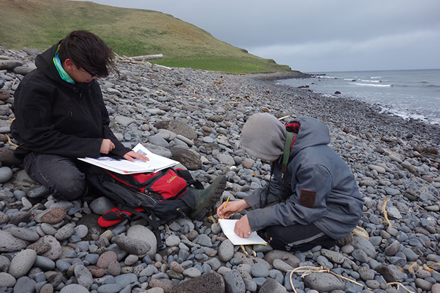 The Coastal Observation and Seabird Survey Team (COASST) is a citizen science project of the University of Washington, which brings many people together to watch beaches. What are they looking for? They’re looking for something unusual. Specifically, they’re looking for birds that have washed up on beaches after dying at sea.
Why is this important? Knowledge of the number of dead birds that usually occur (for example, birds dying from old age and winter storms) is important for scientists to be able to detect unusual numbers of dead birds during an event, like an oil spill, algal bloom, or disease outbreak.
Across Alaska, about 100 people walk study beaches each month. They count the number of dead birds they find. With this information, they help scientists monitor the health of the marine ecosystem from Kotzebue in the north to Ketchikan in the south.
There are six monitoring sites in the Pribilof Islands: four on St. Paul Island and two on St. George Island. Many people from the ecosystem conservation offices of St. Paul and St. George and the Alaska Maritime National Wildlife Refuge work together to monitor these sites.
What species wash ashore in the Pribilofs? The top two are Northern Fulmar and Short-tailed Shearwater. Scientists say this is because both species have relatively large and healthy populations, so some numbers of them wind up on beaches. Changes in the number of birds, or the timing of when they wash ashore could be an indication of changing ocean conditions.
TAKE HOME MESSAGE: By knowing what number of dead birds is “normal” on a particular stretch of coast, scientists can know when an unusual and worrying die-off is happening.
KEY WORDS
Citizen Science: scientific research conducted by amateur or non-professional scientists and the general public.
Algal bloom: rapid increase in population of algae. Some kinds of algae can produce a natural toxin that can be harmful to other marine organisms.
Monitoring: watching for changes over time
KEY CONCEPTS
Acronym: abbreviations formed from the initial letter of component of a word or phrase. COASST stands for Coastal Observation and Seabird Survey Team.
Seabird Populations
Seabird populations are doing different things at St. Paul Island and St. George Island
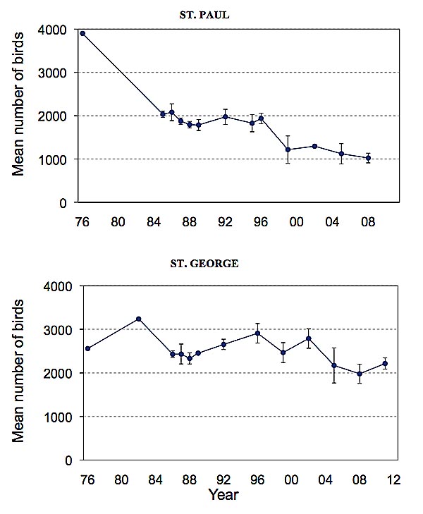 Three scientists examined the long-term population data of four species of seabirds (Black-legged and Red-legged Kittiwakes, and Common and Thick-billed murres) that breed on the Pribilof Islands. Seabirds have been counted on population plots (defined areas of cliffs) on both St. George and St. Paul for the last 30 years. When these count data were examined, the scientists found that recent numbers of birds on St. George Island were similar to those observed in 1976. But seabird populations on St. Paul Island had declined during the same time period (see figure below).
The scientists suggest that these different population trends may be explained by the geographic position of the two islands. St. George is located closer to the edge of the continental shelf. This edge is like a border between the deep water of the sea and shallow water near the islands. Many zooplankton and fish are attracted to this area, and these are important food for seabirds.
Scientists want to know why one population of birds is on the rise while the other is declining. Perhaps the birds on St. George are increasing in population size because they can more easily access the food found at the edge of the continental shelf.
TAKE HOME MESSAGE: Even though St. George Island and St. Paul Island are neighboring islands, their seabird populations don’t follow the same trends.
Researchers: Vernon Byrd, Joel Schmutz and Heather Renner
Figure Legend. Population Counts of Common Murres on St. Paul and St. George Island. These two figures are taken from U.S. Fish and Wildlife Service reports, and show that population data continues to follow the same general trend, with declining populations on St. Paul and more stable populations on St. George.
KEY WORDS
Population: the total number of individuals in an area.
Data: factual information (such as measurements)
Food availability: the amount of food available to a given species.
Mean: find a mean by adding up a list of numbers, then divide by how many numbers there are.
Continental shelf: a shallow underwater plain that forms a border to the continental land mass. It usually ends in a steep slope to the deep ocean water.
Trend: to show a tendency in a general direction.
Data
Where Does it All Go?
Scientists collect LOTS of data. Many species and locations are studied for decades or even centuries, and studies may be passed from one person to another. For example, seabirds on the Pribilofs have been studied for more than 30 years, and there are many species and many kinds of data being collected. For example, researchers may collect data on:
• The number of birds breeding on each island
• What birds are eating
• How many chicks they rear
• How long seabirds live
These data need to be kept safe, and also available so that researchers can ask big questions. Answers to big questions may need data from many years or many locations. For example, researchers examining whether oil drilling would affect seabirds would need access to data from a number of scientists that together provide a picture of where seabirds spend their winter and where the most important breeding colonies are located.
Everyone has different hand-writing, and data recorded on paper can be easily lost or destroyed! Nowadays, most researchers enter all their data on a computer where it can be saved in different places and shared with other researchers. What do data look like? It might be a list of numbers such as bird wing lengths or a list of species nesting on an island.
Many people are also encouraging the set-up and use of shared computer databases, where data from many researchers can be used to answer large conservation questions.
Seabirds.net is a global information site, and you can access many of the seabird shared databases from this website.
Follow the steps below to find out how many Thick-billed Murres breed on the Pribilofs.
1) Go to www.seabirds.net/
2) Click on “Resources”
3) Click on “Seabird Information Network” and you’ll see a list of shared seabird databases
4) Click on “Circumpolar Seabird Data Portal”, then click “enter application”
5) You should see the world map appear. You can use the computer mouse to move around on this map. Find North America… then Alaska… then the Aleutians…
6) You can then click on the zoom (+) button… and find the Pribilofs..
7) Uncheck all the species on the right hand side. And, then just check Thick-billed Murres.
8) You can zoom right in to the Pribilofs, and will see that there are population count data entered for St. Paul, St. George, Otter and Walrus Island. And, there is a productivity index (a rough indicator of how successful birds were at breeding) for both St. George and St. Paul
9) Which Pribilof Island has the most Thick-billed Murres?
TAKE HOME MESSAGE: No one scientist has all the answers. Science progresses as each member of the scientific community produces a small part of the larger answer.
KEY WORDS:
Data: factual information (such as measurements)
Databases: a collection of a large amount of data, usually stored on a computer and organized for quick searching.
Denlinger, L.M. 2006. Alaska Seabird Information Series. Unpublished Report, U.S. Fish and Wildlife Service, Migratory Bird Management, Nongame Program, Anchorage, AK.
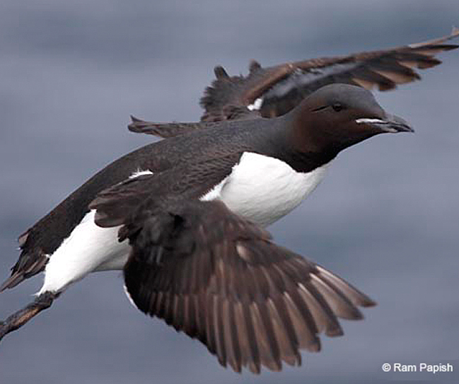
Murres Feeding
 A group of researchers has been examining where Thick-billed murres breeding on three islands in the Bering Sea are feeding. The three islands are Bogoslof (a small island just north of Unalaska in the Aleutians), St. George, and St. Paul
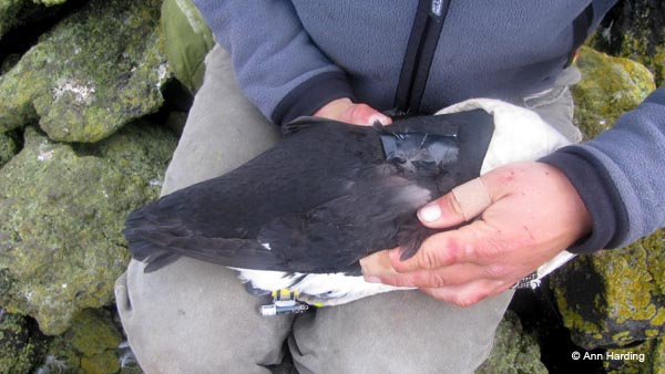
The scientists attached small GPS units (about the size of your thumb) to the back of the Thick-Billed Murres to find out where birds from each island are flying to feed. Murres can dive more than 100 meters deep, and so the GPS units had to be built to be very waterproof and survive high pressures.
The GPS units recorded information about the birds’ location for 1-2 days. Birds were then caught again to download the information onto a computer. The teams spent hours waiting on the cliffs for the birds to return, and then slowly tried to recatch the bird with a noose attached to a long fishing pole!
Most of the GPS units were successfully retrieved, and they provided some exciting data about where the birds were spending their time at sea.
If you look at the figure below, you can see that birds from Bogoslof Island and St. Paul Island made fairly short feeding trips, whereas birds from St. George Island were traveling to the edge of the continental shelf at night to feed.
Zooplankton and fish concentrate at the shelf edge, and this is an important feeding area for seabirds and marine mammals. St. George Island is located closer to the edge of the shelf than St. Paul Island, and it therefore takes less energy and time for St. George birds to commute to this rich feeding area.
SCIENTIST: Rosana Parades, David Irons, Dan Roby, Ann Harding, Rachael Orben
TAKE HOME MESSAGE: Advanced technology can provide incredible insight into bird behavior.
KEY WORDS
GPS: Global Positioning System; a technical navigational tool that uses satellite signals to fix the location of a receiver.
Refuge Monitoring
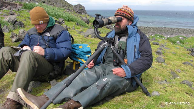 Each summer, people with binoculars and notebooks visit the bird colonies of St. Paul Island and St. George Island. These people spend their days at a particular place on the cliffs, in all kinds of weather, counting birds and writing down numbers. Maybe you’ve seen people with binoculars studying birds.
St. Paul Island and St. George Island are two of nine annual monitoring sites on the Alaska Maritime National Wildlife Refuge. The islands have been part of the refuge’s monitoring program since 1985. Three people are stationed on St. George and two on St. Paul from the middle of May until the end of August each year. The team stays in the historic seal plant at St. George, and at the National Oceanic and Atmospheric Administration(NOAA) bunkhouse near the harbor on St. Paul.
These people also take photos of the bird colonies, at a set place known as a study plot. Nests are numbered on these photos so they can be tracked throughout the breeding season (see photo).
Below is an example of kittiwake breeding success data collected during five visits over about two weeks. Codes are used to identify the contents of a nest: B = bird, E = egg, CH = chick
You can see that eggs in nest #1 were lost (likely because of predators or a storm) between 15-19 July, whereas one chick hatched between 11-15 July and the second chick hatched between 15-19 in nest #2.
Data such as these can tell us how many eggs on average were laid per nest in a given year. Scientists can also learn how many chicks hatched and then survived to fledging.
Monitoring programs focus on certain breeding colonies and species, and record data (annually, biannually, or even once every 5 or 10 years) on population size, breeding success, adult survival, and diet.
Why do scientists spend so much time monitoring birds in the Pribilof Islands and at places all across the world? We can learn a lot from carefully watching the bird colonies.
For example, we have learned that kittiwakes breeding in the Atlantic Ocean rear more chicks but don’t live as long as kittiwakes that breed in the Pacific Ocean. Monitoring data can be used to detect effects of an oil spill, commercial fishing, and climate change, and are important for making management decisions such as which species need protection.
|
NEST |
3-Jul |
7-Jul |
11-Jul |
15-Jul |
19-Jul |
|
1 |
B/2E |
B/2E |
B/2E |
B/2E |
empty |
|
2 |
B/2E |
B/2E |
B/2E |
B/1E, 1CH |
B/2CH |
|
3 |
B/1E |
B/1E |
B/1E |
B/1E |
B/1E |
|
4 |
B/1E |
B/1E |
B/1CH |
B/1CH |
B/1CH |
|
5 |
B/2E |
B/2E |
B/2E |
B/2E |
B/2 |
Key Words
Monitoring: watching for changes over time
Breeding success: how many chicks parents successfully rear.
Fledge, or fledging: the meaning of fledging differs among species. Birds are sometimes considered fledged once they leave the nest, even if they cannot fly yet (like murres). Some definitions of fledge mean when the chick leaves the nest and is independent from the adults (like kittiwakes).
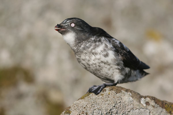
Least Auklet
You might say that the Least Auklet knows how to pack a lunch. The Least Auklet can pack more than 700 tiny zooplankton in a small pouch under its tongue. This “lunch” isn’t for the grown-up bird, however. It’s food for the chick, which the parent delivers after returning from the sea.
This special lunch pouch is a helpful tool for scientists who want to know what birds are eating. To learn what’s on the menu, simply look in the lunch pouch!
And here’s what scientists discovered by analyzing what they found in the lunch pouch: after cold winters, auklets were eating their favorite species of zooplanton, a small copepod that has lots of energy-rich fat! After warm winters, birds ate other types of zooplankton that were not as nutritious as the copepods.
This means that warming ocean temperatures in the Bering Sea may be reducing the availability of more nutritious food for Least Auklets breeding on the Pribilof Islands.
RESEARCHERS: Ine Dorresteiin and Alexander Kitaysky.
TAKE HOME MESSAGE: Least Auklets may not be able to find enough nutritious food to eat if climate warming continues in the Bering Sea.
KEY CONCEPTS
Food availability: the amount of food available to a given species.
Ocean temperature:Sea surface temperature (SST) is most often used to measure the ocean’s temperature. Surface is between 1 millimeter and 20 meters below the sea surface.
KEY WORDS
Copepod:Small crustaceans found in the sea and most freshwater habitats. Copepod means “oar-feet.”