St George Island is home to roughly half a million red-legged kittiwakes and the majority of these birds nest on the north facing cliffs of the island.
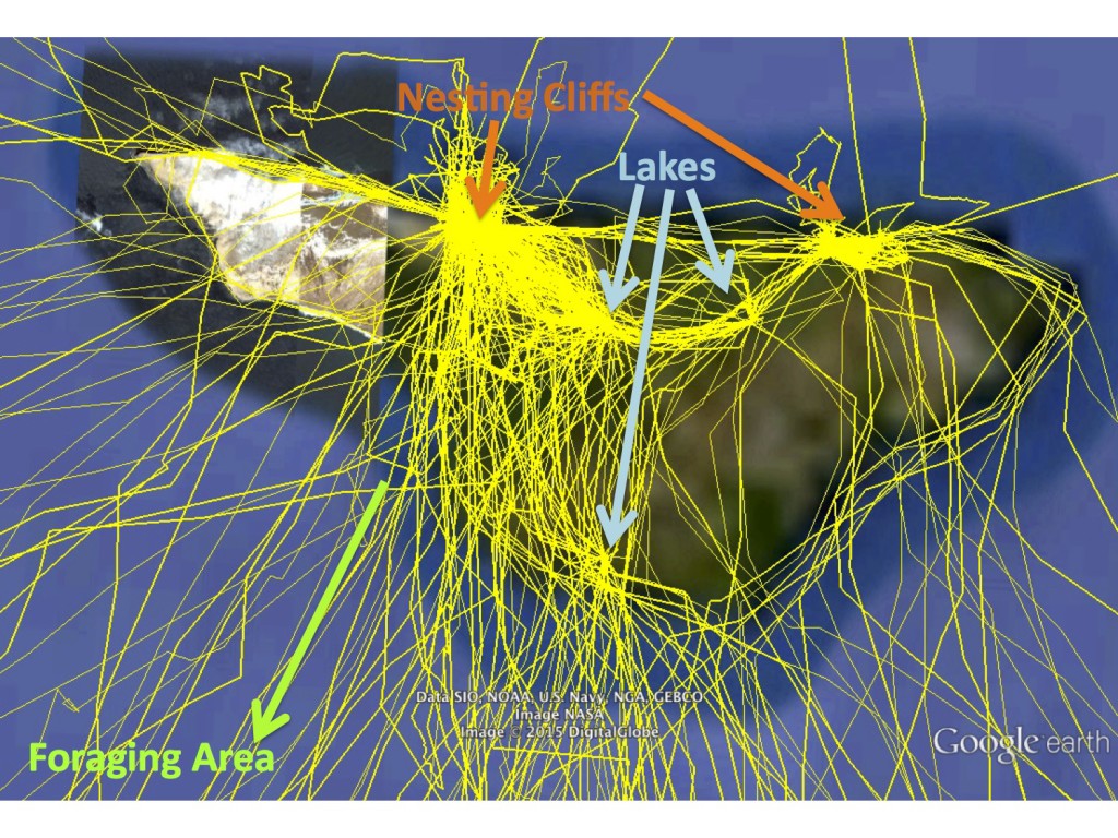
The main foraging area for red-legged kittiwakes is located to the southwest of St. George, out past the shelf break and into the deep waters of the Bering Sea. This means that with each foraging trip a bird needs to cross or circle the island to head out to sea.
On a clear day (which doesn’t happen too often!), from the top of High Bluffs (the highest cliffs on the island) you can sit back and watch the birds flying along top of the cliffs using the updrafts (depending on how the wind is blowing) and crossing the island.
Check out the GPS tracks on the map below that shows the traffic patterns of red-legged kittiwakes departing and returning to their nests on the North Cliffs on St. George Island.
GPS loggers provide a lot of data, and one of the most important (and time-consuming) jobs of the researcher is to be able to sort through all this data to identify and pull out just the foraging trips. Kittiwakes leave their nests to avoid predators (such as foxes), bath in the lakes, collect nesting material, and socialize. Remember some of these tracks are from birds that haven’t laid their eggs yet, so they are more likely to leave the nest on short trips than birds that are incubating.
Rachael sorted trips away from the nest using a set of rules or ‘criteria’ that are created with knowledge from prior studies on red-legged kittiwakes. These were:
(1) A trip must have three GPS points, so this meant that trips had to be at least 9 minutes long (since GPS locations are recorded every three minutes). This gave her 674 trips away from the nest – yikes!
(2) To identify foraging trips, she then used a much larger scale definition where a bird had to leave the nest site for more than 10 hours and travel more than 20 kilometres away from the nest.
This second criteria works well for red-legged kittiwakes, but wouldn’t work very well for species like black-legged kittiwakes or thick-billed murres that are known (from prior studies) to feed much closer to the island and to take shorter trips.
The criteria are just a simple way to split the trips and to make sure that she’d picked reasonable values and to see if her criteria would work Rachael then plotted the tracks.
The below map shows just the short trips around St. George Island. Each blue dot represents a GPS location and the green lines are simply connecting the dots as a best guess where the birds were flying.
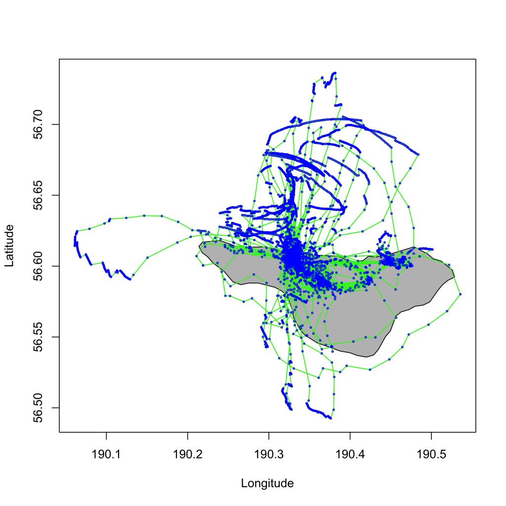
What do you think the birds to the north of St. George were doing? Hint: we only saw this type of trip before the birds laid their eggs.
Can you find the airport on St. George? You can see a straight-line of blue dots inland near the south coast. Birds were hanging out together (or “loafing”) on the runway.