Last summer, Rachael Orben and Abram Fleishman attached GPS loggers to red-legged kittiwakes on St. George Island to find out where they were finding food during both the pre-lay and incubation phase of the breeding season.
Both members of a red-legged kittiwake pair are fairly free to forage before eggs are laid, although they still need to attend the colony to defend their nest site. However, parents need to alternate who incubates the egg and who takes a trip out to sea to forage once the egg has been laid.
By tracking birds during both the pre-lay and incubation phase of the breeding season the team will be able to better understand how foraging changes both through time and with different constraints on parental time and energy.
After months spent analysing the data, Rachael is starting to see some cool results. Read more to find out what the team has learned so far:
First, they learned some really basic things about the behaviour of red-legged kittiwakes away from the colony.
Red-legged kittiwakes spend the majority of their time in the Bering Sea. The Bering Sea is a marginal sea of the North Pacific, meaning that it separated from the open Pacific Ocean by the Aleutian Island chain. The Pribilof Islands, where most of the world’s population of red-legged kittiwakes nest, are located on the continental shelf in the southeastern Bering Sea. Importantly, the Pribilof Islands are located near the shelf break where the sea floor drops rapidly into the deep waters of the basin. This break at the edge of the continental shelf is also known as the “greenbelt” because nutrients from the cold waters of the deep basin flow up the slope and result in a fairly constant production of phytoplankton.
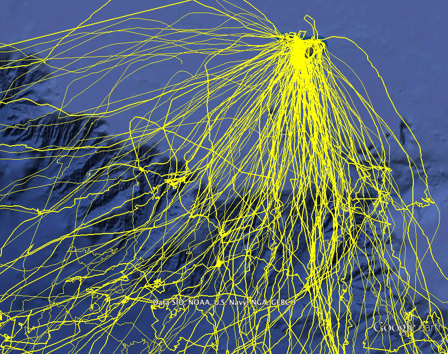
The map below shows the area of the Bering Sea where the red-legged kittiwakes visited just before they laid their eggs (in pink) and while they were incubating their eggs (in yellow). These are tracks from 45 individual (different) birds.
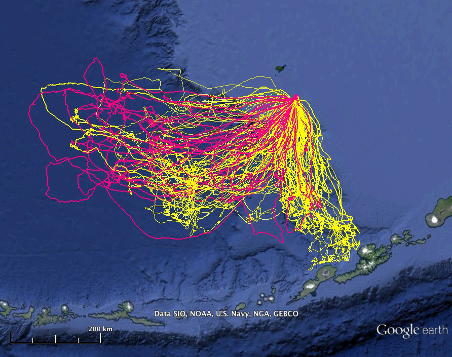
Some questions for you:
(1) Where is St. George Island?
(2) What is the island called just to the north of St. George?
(3) Can you spot some differences or some similarities in their behaviour between pre-lay and incubation?
(4) Can you see the line of the continental shelf?
Remember we collected these locations from birds carrying GPS dataloggers taped (with very special tape) to their tails. The loggers turn on every 3 minutes to record a location fix.
What other patterns can we pick out in this spaghetti of tracks?
Areas where the bird slows down and starts flying in circles or has a lot of movement in a small area are potential locations where a bird is foraging (looking for food). See example in below map. This type of movement is called area-restricted search.
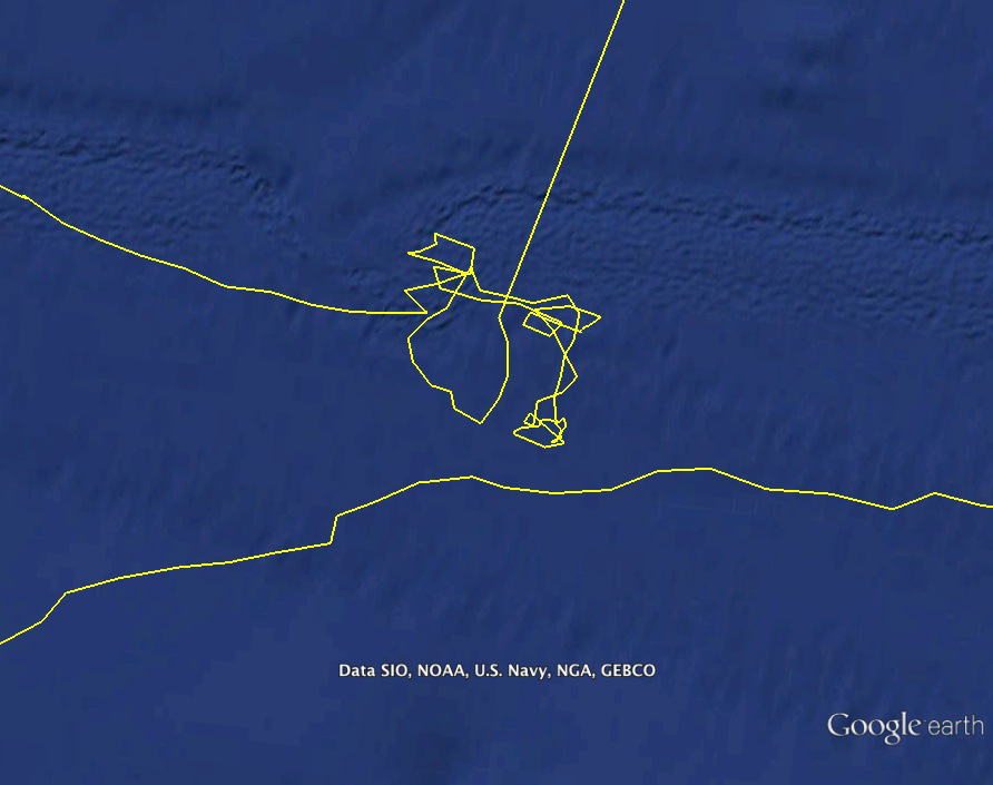
Red-legged kittiwakes often fly in a straight line over the continental shelf, and then start searching for food once they cross the shelf break.
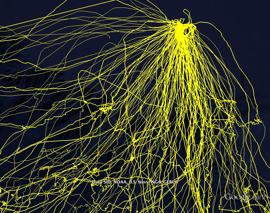
Check out the two maps below:
(1) Can you guess where the shelf-break is from the GPS tracks in the first map?
(2) Why do you think they might skip over the shelf and head much farther away from the breeding colony to find food?
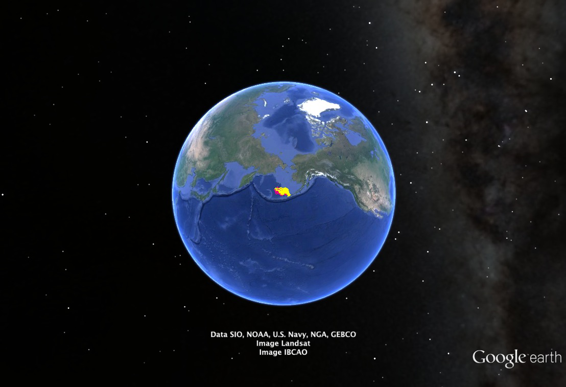
Finally, we also learned that the foraging area of red-legged kittiwakes breeding on St. George Island is large enough to be visible a long way off. Our red-legged kittiwake tracks are shown in yellow and red in the below map!

How cool is that!