I had a great time talking with you all via Skype in April. Thanks for all your awesome questions, and to Ms. Kushin and Mr. Fay for hosting my remote visits.I am not really sure where all the time has gone since then, but in mid-May I will be flying north to Anchorage and then on to St George Island. Abram (see “Meet the team”) and I will hopefully be arriving on May 20th.
Still so many things to do!
I am continually writing and modifying my to-do list. I am categorizing tasks into ‘personal’ (so I don’t forget my toothbrush and hiking boots!), ‘food and accommodation tasks’, and then preparation for all the exciting science that we are planning to do.
On the top of my list is testing out our GPS loggers. Using technology is incredible in allowing us to collect data and answer questions that would be impossible otherwise, but it does require that all the technology works (even in the cold and wet weather conditions that we will probably encounter).
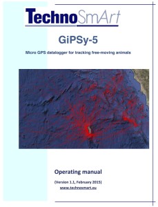
As with any new technology it is good to start with reading the directions.
Next I will go through and turn each GPS logger on and start it logging (collecting data) to make sure they all work.
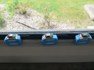
For my first test, I will simply set them in the window where they have partial view of the sky and let them log (collect data on position and time) at one-second intervals. This will give me an idea of battery life. After a couple of days (as I am not quite sure how long the batteries will last!), I will charge all the loggers and download the data.
For my second GPS test, I will program each logger to collect the same data that they will when attached to the tails of the red-legged kittiwakes (recording location every 120 seconds). The batteries of the loggers will hopefully last up to 7 days during this test. Again I will put them in the window so they will only have a partial view of the sky. When the kittiwakes are out at sea the GPS loggers will hopefully have much better satellite reception, but this test will give me a conservative estimate of how long the GPS will continue to record.
How do GPS loggers work anyway?
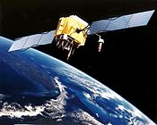
The Global Positioning System (GPS) is a network of satellites located about 20,000 km above the earth’s surface. Each satellite orbits the earth twice in one day and 24 satellites are needed to maintain full GPS coverage. The little GPS datalogger that we will use to track the red-legged kittiwakes is a basically a circuit board attached to a battery with a small antenna that is able to receive signals from these satellites. Pretty cool! The GPS chip needs to record signals from 3 or more satellites to calculate locations based on the identity of the satellites and the time of these transmissions. And it does this at the pre-programmed time interval so we can then track the movement of the birds as they forage out at sea.
http://en.wikipedia.org/wiki/Global_Positioning_System
Artist’s conception of GPS Block II-F satellite in earth orbit.
DATA!
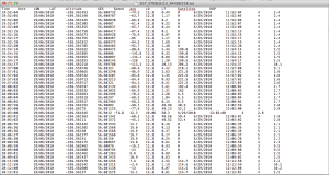
We attach the GPS logger to our computer and download the data. The data looks like the below example; with date, time, latitude and longitude.
Abram and I will be in the field from end of May until July, but most of the action will be in June. I’m hoping that some of the students on St. George can visit us in the field, or at least see the GPS loggers and some of the maps of where the red-legged kittiwakes are foraging as we collect the data this summer.
And, I’ll be posting a couple of blog updates from the field to share our adventures and some initial results. Stay tuned…


