Marine habitat use by seabirds of the Pribilof Islands Marine Ecosystem (PRIME)
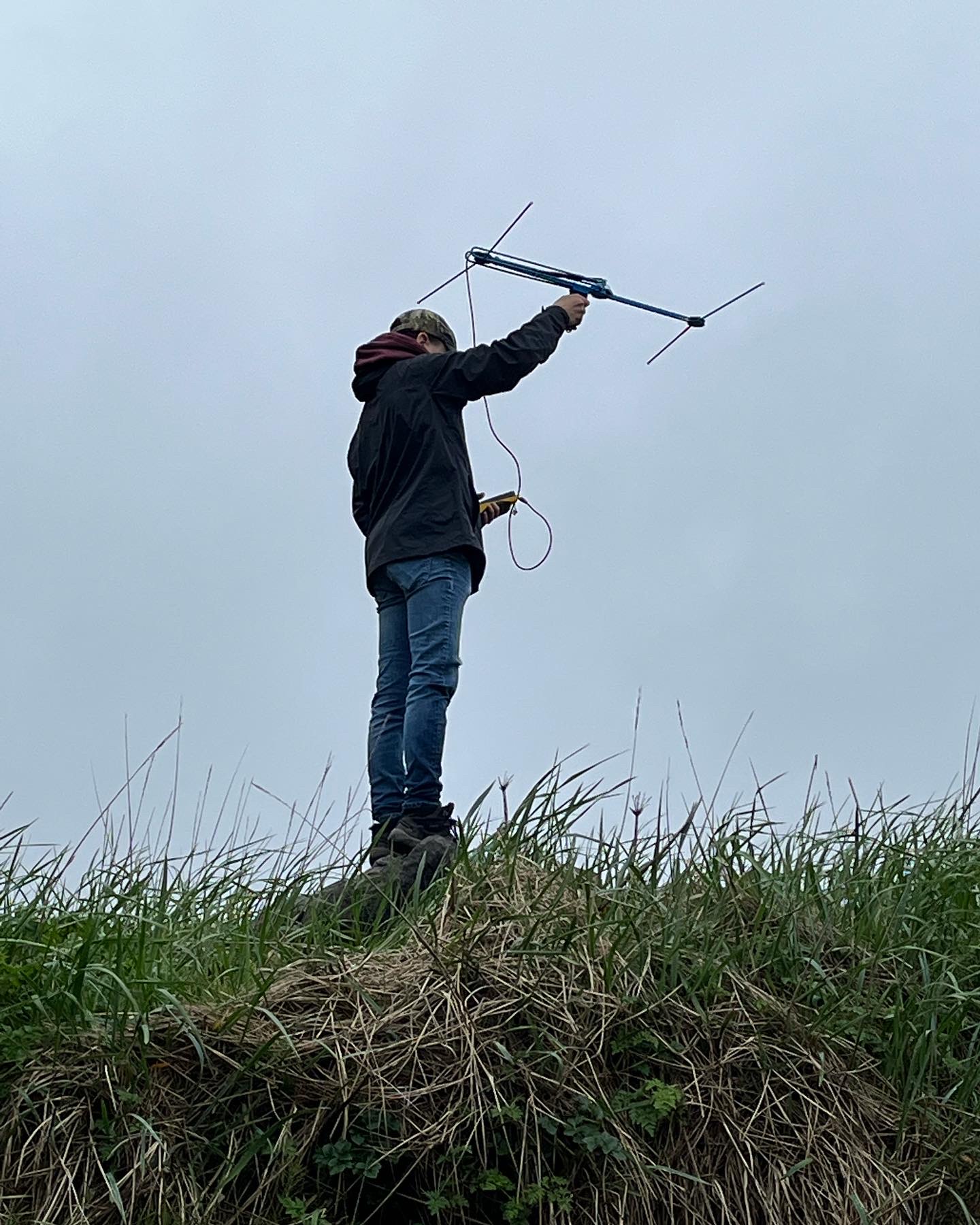
Last summer, our research crew spent their first field season attaching both GPS and geolocator loggers on Black-Legged Kittiwakes nesting at St Paul Island (Alaska). GPS loggers were used to find out where these seabirds spent their time during the summer breeding season, and the geolocator loggers are being used to see where the birds spend their time during the winter months.
Summer Movements:
GPS tags are larger than the geolocator tags, and weigh about 8 grams (about the weight as a pencil). GPS tags are used to record fine-scale movements over a relatively short time period. The length of the recording time of these GPS loggers is limited by battery life… the size of the battery is limited by the weight of the logger…, and the weight of the logger is limited by the size of the bird. You never want to attach any device to a bird that affects how it behaves (both because biologists are interested in recording “real” behavior, and we also don’t want to affect the survival of the birds we are studying). Biologists usually aim on using loggers that are less than 3% of the birds’ body weight. Black legged kittiwakes weigh 305-550 grams, and so an 8-gram GPS tag represents about 1.5 to 2.5% of its body weight.
GPS loggers are usually deployed on seabirds during the breeding season, where birds are easy to catch on the nest when they come back to feed their chicks. The GPS loggers record the location of the birds every 15 mins, and this gives us accurate information about where parent birds are flying to find food for both themselves and their chicks.
Last summer, we deployed three GPS tags that tracked Black-legged kittiwakes with chicks over a period of 5-10 days
The results are exciting!
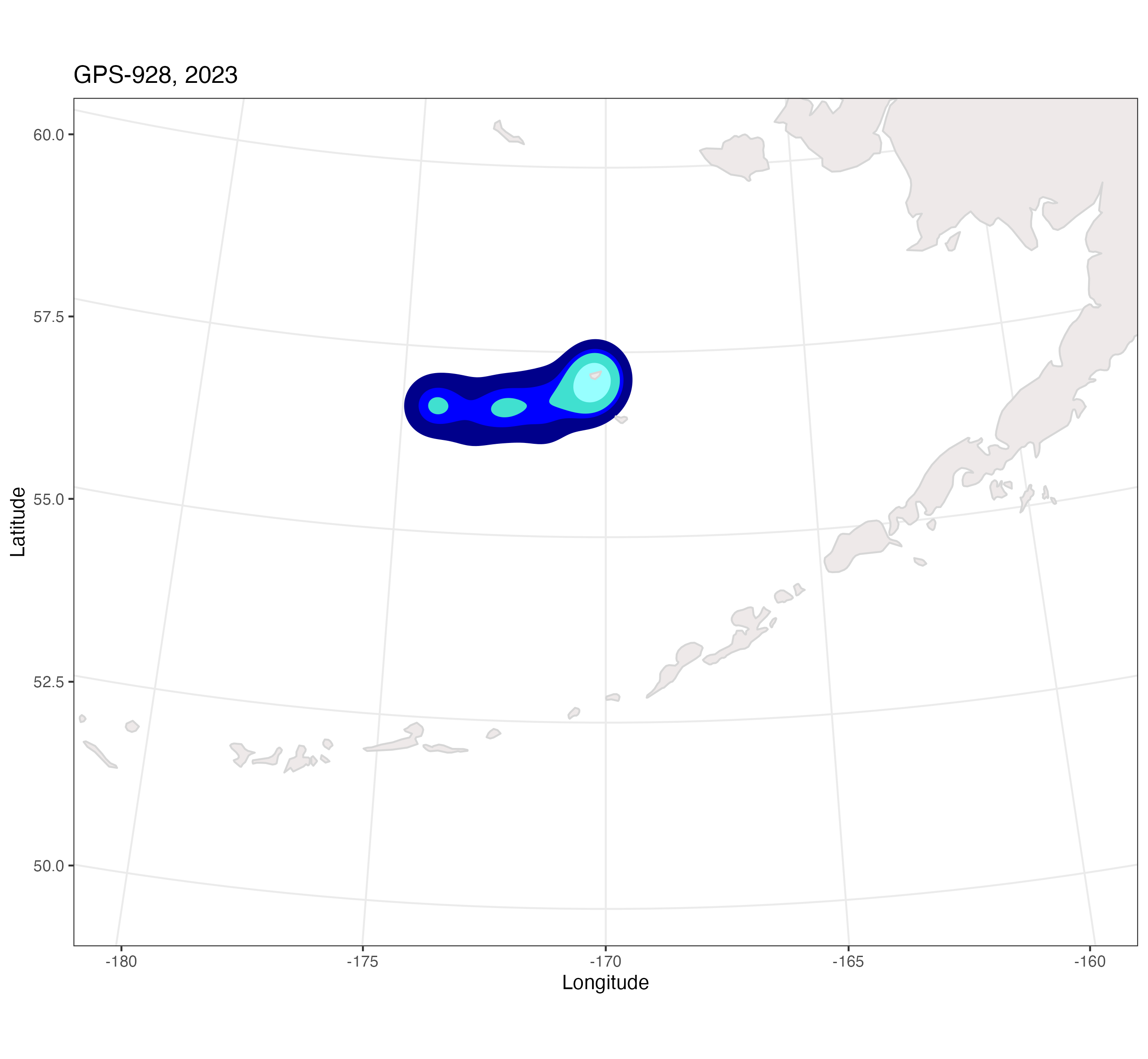
Figure showing where black-legged kittiwakes breeding on St. Paul Island go to find their food during the breeding season. It is useful to view GPS location data using variation in shading to show where birds are spending most of their time at sea. In this figure, pale shading represents areas where birds spend the least amount of their time, and the darker shades show where birds spend the most time. Not surprisingly, these results show that birds spend most of their time away from the colony feeding in ocean waters, and much less of their time at the colony with their chicks. These parents are busy!
This coming summer, we plan to deploy another 3-5 GPS tags throughout the summer on multiple individuals, aiming to GPS track up to 15 adult kittiwakes. We also plan to take small blood samples from the birds we catch to look for mercury levels. The Bering Sea Campus on St. Paul Island will do the blood-mercury analysis. The combined information on at-sea movements and mercury levels should help us understand whether certain foraging regions or prey-types could be exposing the birds to higher levels of mercury. Mercury is a heavy metal, and it can affect the survival of seabirds Mercury has been found in high concentrations in some regions of the Aleutian Islands.
Winter movements
The geolocator loggers are much smaller than the GPS loggers and only weigh 1 gram. These tiny loggers are attached to a plastic band on the bird’s leg. The birds wear the logger for a year. They are then recaught, the band and logger is removed, and the data is downloaded from the logger. These data record the location of the bird over the whole year, and help us understand what regions of the ocean the birds are relying on during the non-breeding season.

Geolocator band on a black-legged kittiwake, photo by Dan Cushing
Last summer, we deployed a total of 15 GLS tags on adult kittiwakes, and we are eagerly awaiting to find out which birds have returned with our loggers!